One of 20 self-guided London walks on this site. See every walk, from the South Bank to Hampstead Heath.
In this guide
The Thames Path runs 185 miles from its source in Gloucestershire, but the stretch through London is the most consistently walkable part of it — flat, mostly signposted, and lined with the kind of thing you’d otherwise pay a guide to point out.
These are the routes worth planning around, all free.
💡 The Short Version: Westminster to Tower Bridge on the south bank is the classic hour. Rotherhithe to Greenwich is the quiet stretch almost nobody else walks. Wapping to Limehouse is the riverside pub route. And the City on a Sunday is empty and extraordinary.
📘 How we choose these (editorial note). No paid placements. These are drawn from a wide spread of sources rather than any single list - the food and travel press, the big listings sites, independent blogs and specialists, video, and what Londoners recommend themselves - and cross-referenced against each other. Timings are walking pace without stopping — every route here has enough on it that you should double them.
The South Bank: Westminster to Tower Bridge
About an hour · entirely riverside · free
The classic London walk and still the best introduction to the city.
The route: Westminster Bridge → the London Eye → Southbank Centre → the National Theatre → Gabriel’s Wharf → Tate Modern → Millennium Bridge → Shakespeare’s Globe → Borough Market → HMS Belfast → Tower Bridge.
Worth stopping for: Tate Modern, the second-hand book market under Waterloo Bridge, Forza Wine’s terrace on top of the National Theatre, and Borough Market — which is closed on Mondays.
We have this one stop by stop → — eleven numbered stops with a map, a Google Maps walking link and what is open on which day. Use that if this is the stretch you are actually walking; the rest of this page is the other six.
Detour: cross the Millennium Bridge for St Paul’s, which is the view the bridge was built to frame.
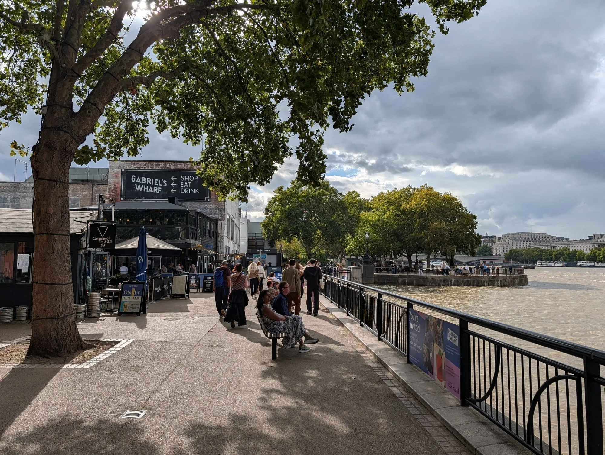
Gabriel’s Wharf.
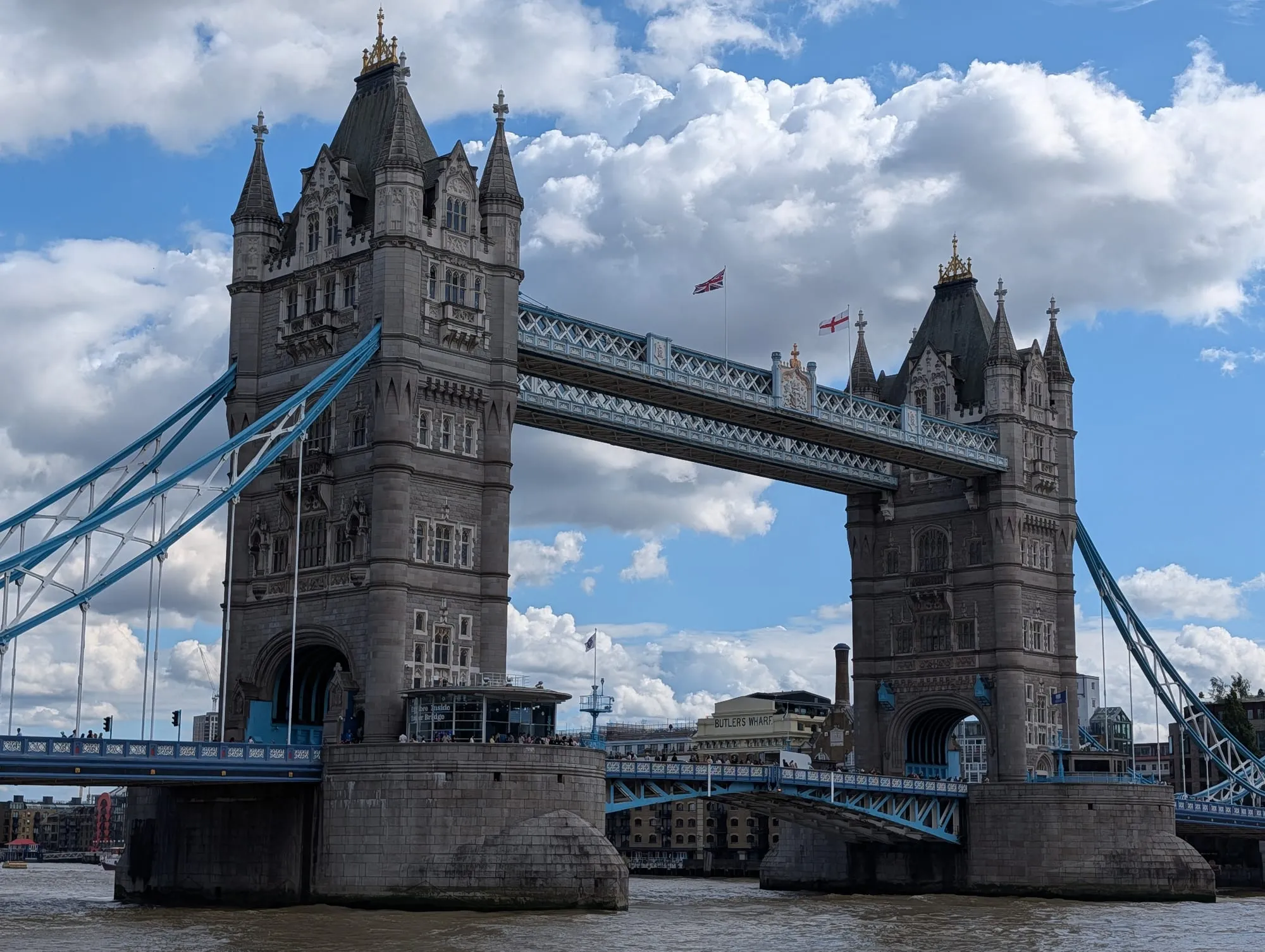
Tower Bridge, the end of the walk.
🛶 Want the canal instead of the river? The Regent’s Canal is its own walk entirely — 8.6 miles and 13 locks from Little Venice to Limehouse Basin, broken into sections that each end at a Tube station. See our full canal walks guide for it section by section.
Wapping to Limehouse: the riverside pubs
About 40 minutes · free · best at high tide
The oldest pubs in London, in order, along the river.
The route: Tower Bridge → St Katharine Docks → The Town of Ramsgate (a pub here since 1545) → Wapping Old Stairs → Turner’s Old Star → The Captain Kidd → The Prospect of Whitby → The Grapes in Limehouse.
The riverside pub walk from Wapping to Canary Wharf, stop by stop → — the Town of Ramsgate, the Captain Kidd, the Prospect of Whitby and the Grapes as eleven numbered stops, with the Ornamental Canal and Tideway’s new riverside park at Shadwell in between. It has a map, each pub’s hours and kitchen times, who takes bookings, and carries on to Canary Wharf.
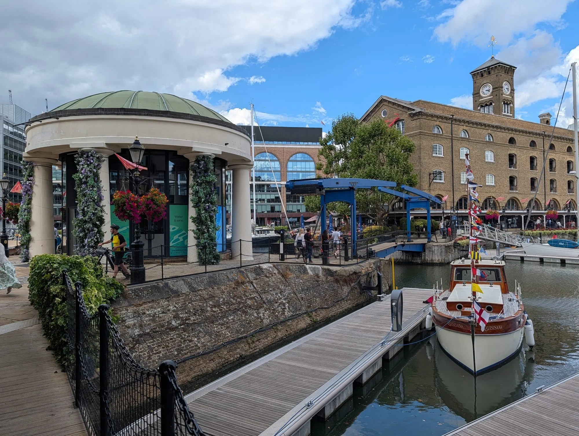
St Katharine Docks.
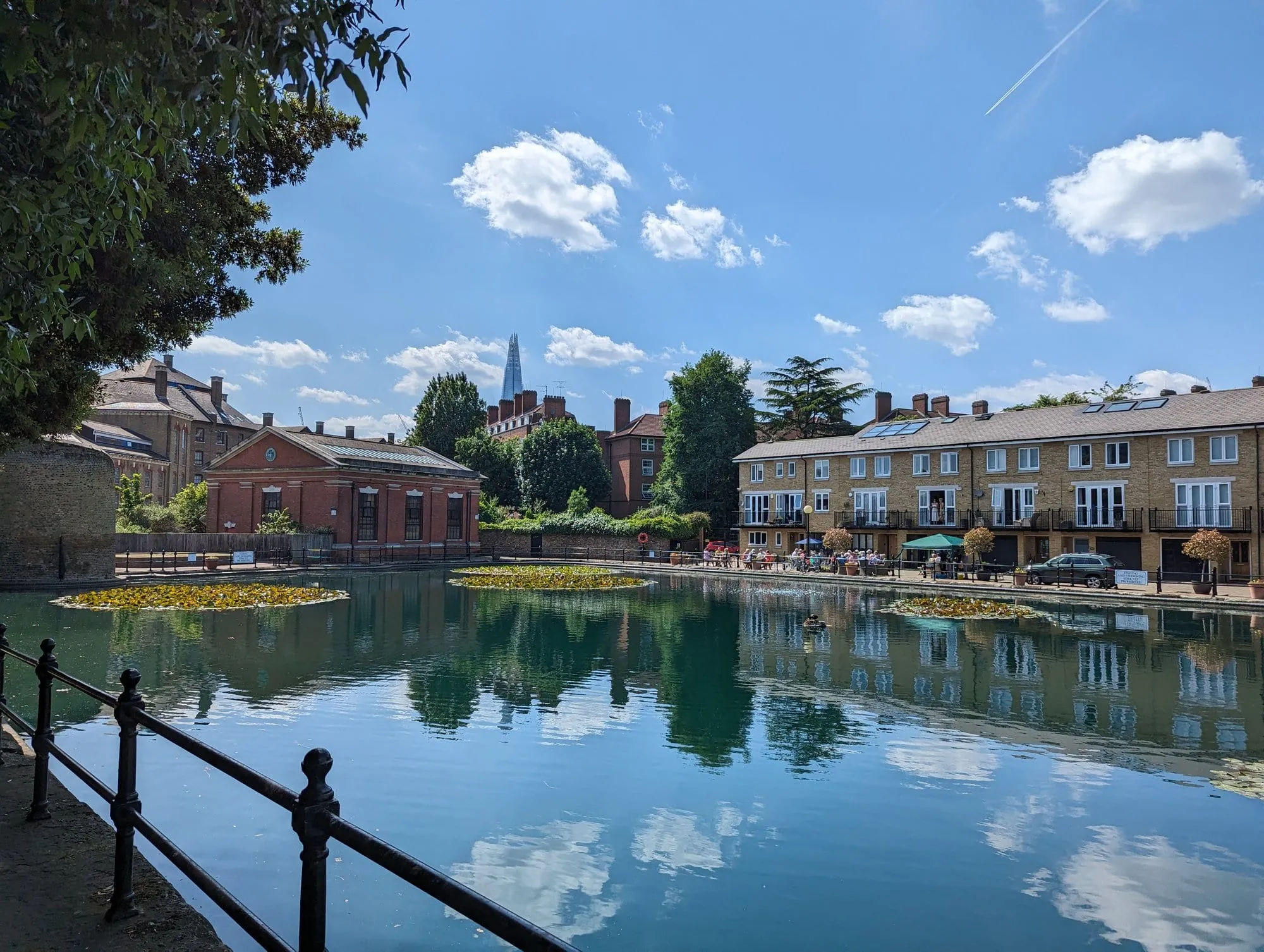
One of Wapping’s old docks.
Wapping Old Stairs is where condemned prisoners were chained at low tide. The Grapes is part-owned by Ian McKellen and Dickens drank there.
The City on a Sunday
As long as you like · free · Sundays only
The Square Mile empties completely at weekends, which makes it the best time to walk it and the worst time to try to go inside anything.
Worth finding: Postman’s Park, St Dunstan in the East, Leadenhall Market’s exterior, the Roman wall at Tower Hill, and the Barbican highwalks.
⚠️ Almost everything is closed. This is a walk, not a day out — bring a coffee with you.
Under the river: the docks to the Observatory
About 6.5km · 3–4 hours · free
The only walk on this page that crosses the Thames without a bridge. It runs south down the Isle of Dogs past the old docks and Mudchute Farm, dives under the river through the 1902 Greenwich Foot Tunnel at Island Gardens, and comes up beside the Cutty Sark with the whole of Maritime Greenwich in front of you. Coming up on the Greenwich side is the best free reveal in London, and it only works in this direction.
The Royal Observatory at the end of it is closed from 2 November 2026, so the walk finishes on the hill above it.
We have this one stop by stop → — the full Canary Wharf to Greenwich walk via the Isle of Dogs, eleven numbered stops with a map, a Google Maps walking link, the live status of the foot tunnel’s lifts and what is open on which day. Use that if this is the stretch you are actually walking; the rest of this page is the other six.
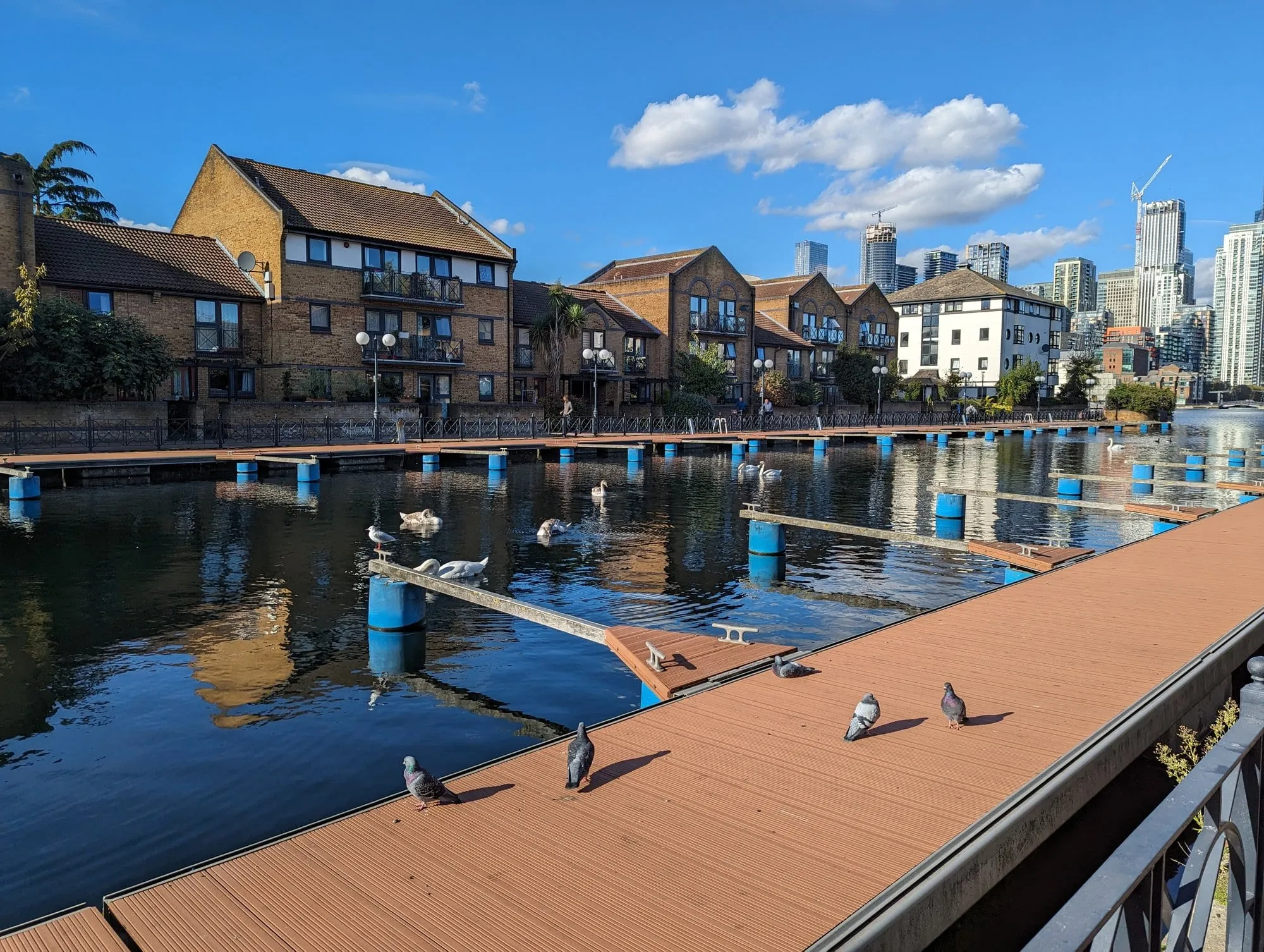
One of the Isle of Dogs’ old docks.
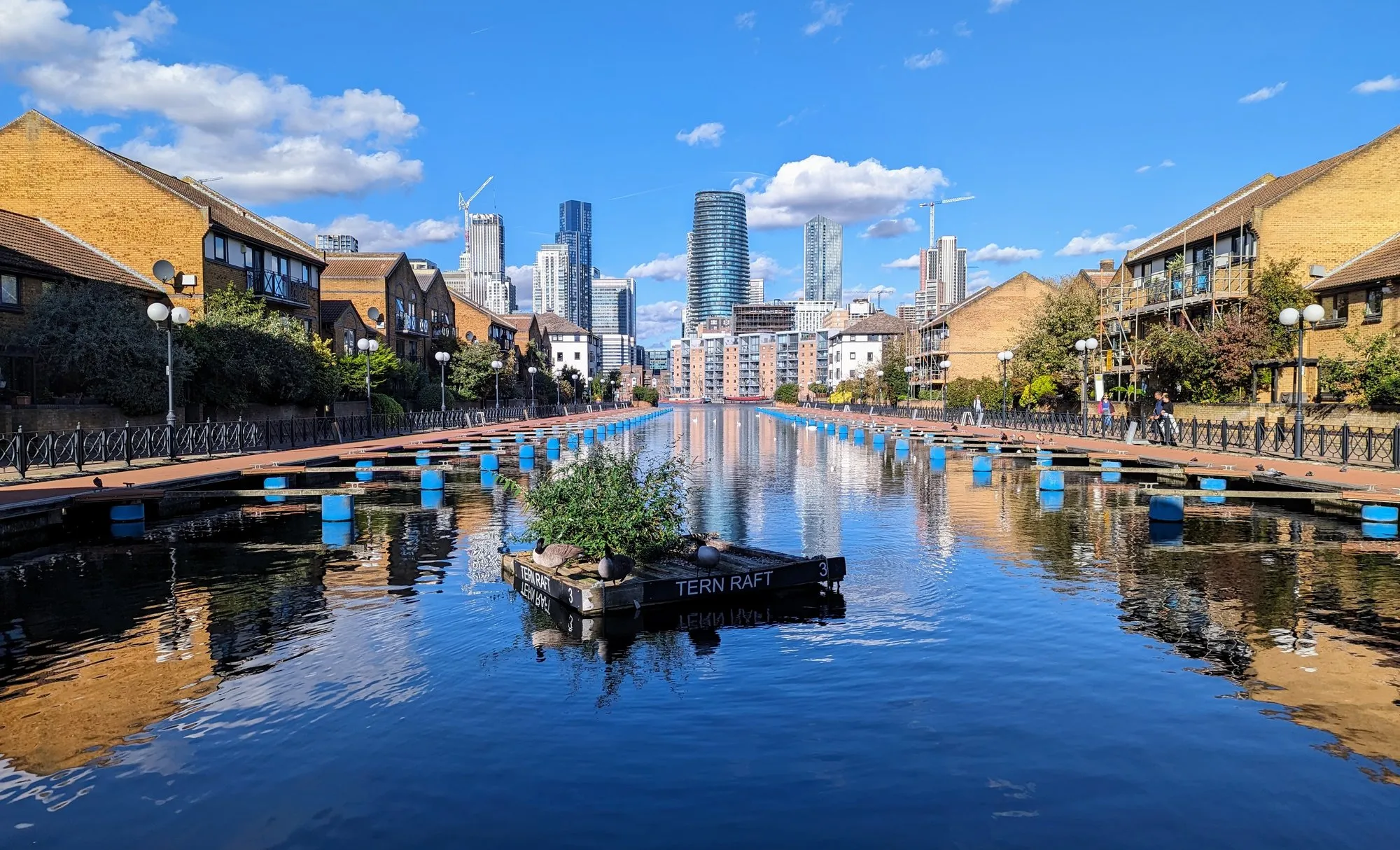
Rotherhithe to Greenwich: the quiet stretch
About 4 miles · 1 hour 45 · Rotherhithe to Cutty Sark DLR
The bit of the Thames Path almost nobody walks, and the better for it. From Rotherhithe the route runs past the Mayflower — the pub beside the steps the Pilgrims’ ship left from — through Surrey Docks and the old timber ponds, round the peninsula at Greenland Dock, and into Deptford past the site of Henry VIII’s naval dockyard.
You emerge at the Cutty Sark with the Old Royal Naval College ahead of you, which is the best arrival on the whole river.
Stave Hill is a short detour inland: an artificial mound with a bronze relief on top mapping the docks that used to be here, and a 360-degree view over what replaced them.
Battersea to Putney: the boat race stretch
About 4.5 miles · 1 hour 45 · Battersea Power Station to Putney Bridge
Mostly flat, mostly quiet, and the reverse of the Championship Course the Boat Race is rowed on. Past Battersea Park and the Peace Pagoda, under the pink-and-green Albert Bridge, along the Wandsworth reach and into Putney where the rowing clubs line the embankment.
Best done on a spring morning when the crews are out. On Boat Race day itself the towpath is packed for hours before the start.
Thames Barrier to the Woolwich Ferry
About 2 miles · 45 minutes · Charlton to Woolwich
Short, strange and almost empty. The Thames Barrier is the end of the Thames Path’s London section — ten steel gates across 520 metres of river, each as tall as a five-storey building, and the Information Centre on the south bank explains what happens when they close.
Walk east from there to the Woolwich Ferry, which is free, takes vehicles and foot passengers, and has crossed the river on that spot since 1889.
Practical notes for walking the river
- The tide runs fast and the foreshore is not a beach. The stairs at Wapping, Bankside and Rotherhithe are only usable around low water, and the river comes back in more quickly than people expect. Check a tide table before going down.
- Mudlarking needs a permit. Even picking things up off the foreshore requires a Port of London Authority licence, and they are limited. Looking is free.
- The path is not continuous. Development, private wharves and construction close sections at both ends of the city. The signage is good where it exists and absent where it does not.
- North bank or south? The south is more continuous and greener; the north has more of the historic pubs and the City. Between Westminster and Tower Bridge the south bank is the better walk by some margin.
- Bridges are the decision points. Every bridge is free to cross, and most walks work better as a loop over two of them than as an out-and-back.
What it costs
Nothing. The Thames Path is a National Trail, free and open at all hours along almost its entire London length.
- The whole path runs 185 miles from the source in Gloucestershire to the Thames Barrier, and the London stretch is the most consistently walkable part of it.
- Bridges are free, including Tower Bridge’s pavement — you only pay for the high-level walkways.
- The one thing you pay for is getting back. Walk one way and take the Tube, the DLR or a Thames Clipper back. The Clipper is the most enjoyable and the most expensive; a river bus fare is well above a Tube one.
- The Greenwich Foot Tunnel is free, open 24 hours to pedestrians, and the most interesting way to cross the river in east London. The lifts at both ends now run 24 hours too, and the Royal Borough of Greenwich publishes a live status page for them.
- Check tide times for the foreshore sections. The river comes in fast, and the stairs down to the beach at Wapping and Bankside are only usable at low water.
Prefer to see the river from the water instead of the towpath one day.
What to know
- The Thames Path is signposted and runs on at least one bank the whole way through London.
- Check the tide on the river walks — the Thames drops a long way and the foreshore appears. Do not go down onto it without checking the tide table.
- Comfortable shoes beat any travel advice anyone will give you about London.
Continue planning your London trip
- 🌇 The Best Rooftop and Riverside Restaurants in London — where to eat on the stretch you are walking
- 🛶 Best Canal Walks in London
- 🚇 Canary Wharf to Greenwich Under the River
- 🥾 The Hampstead Heath to Primrose Hill Walk
- 🎪 Free Things to Do in London
- 👀 The Best Views in London
- 🍺 Historic Pubs and Dining Rooms in London
- ⛵ Greenwich Area Guide
- 🚂 King’s Cross Area Guide
Common questions
What is the best walk in London?
The South Bank from Westminster to Tower Bridge is the classic — about an hour, entirely riverside, and it passes Tate Modern, the Globe, Borough Market and HMS Belfast. Wapping to Limehouse is the best one if you'd rather do it pub by pub.
Can you walk along the whole Thames in London?
The Thames Path runs the full length on at least one bank, and mostly both. The best central stretch is Westminster to Tower Bridge on the south side; the best eastern stretch is Wapping to Limehouse.
Which side of the Thames is better to walk?
The south bank is more continuous and greener; the north has more of the historic pubs and the City. Between Westminster and Tower Bridge specifically, the south bank is the better walk by some margin.
Do you need a permit to search the Thames foreshore?
Yes — even picking things up off the mud requires a Port of London Authority licence, and they are limited. Looking without touching is free, and the foreshore is only exposed at low tide.
Are London river walks free?
All of these are. Guided walking tours charge for the commentary, but every route here is a public path, and the Thames Path itself is a National Trail.